A drone-based disaster-management programme helped Mozambique’s Marracuene district locate families, map damaged roads and direct rescuers during severe floods.
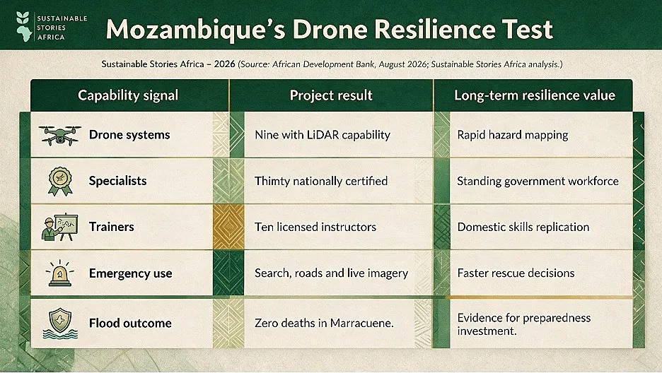
The district recorded no flood fatalities, while thirty government specialists later graduated as certified drone pilots.
The project’s lasting value lies not only in equipment, but in national skills and coordination built before disaster struck.
Training Met an Unscheduled Final Test
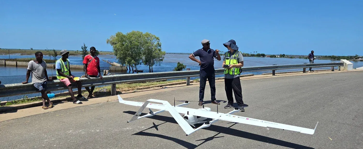
When weeks of rain submerged homes and farmland across Mozambique’s Maputo and Gaza provinces, drones flown by a partly trained government cohort helped locate stranded families, map washed-out roads and stream live images to rescue teams.
Marracuene district emerged from what its mayor called an unprecedented flood without recording a single loss of life.
For resident Preciosa Mondlane, the aircraft circling above the wreckage of her Ricatla home initially raised uncertainty.
They were, however, part of a disaster-management capability being built by the Government of Mozambique, the African Development Bank and Korea.
The emergency arrived before formal operations were due to begin.
Equipment intended for training became an immediate public-safety tool, and the learners faced a real disaster months ahead of schedule.
Partnership Invested in National Capability
Financed through the Korea-Africa Economic Cooperation Trust Fund, the Drone-Based Disaster Management Project started in April 2025.
- It supplied nine drone systems with LiDAR sensors, simulators, unmanned surface vessels and data platforms.
More importantly, it trained thirty specialists drawn from the weather service, water directorate, mapping and roads agencies, and national disaster institute.
- None had flown drones previously.
- They learned the full chain from data collection to processing and interpretation.
The aim was knowledge transfer, not simply technology donation.
- Ten participants were prepared to train others, creating a pathway for domestic capacity to continue after external support.
Local Skills Outlast Donated Equipment
In July, all thirty pilots graduated with national certification, including ten authorised instructors.
- Their institutions now contribute to a technical council for disaster response, linking meteorology, mapping, roads, water and emergency management.
That institutional connection is central.
- Drones only save time when data reaches a decision-maker, triggers action and aligns with boats, shelters, health services and local warnings.
- Equipment without maintenance budgets, trained analysts and operating protocols can quickly become unusable.
Mozambique’s experience also shows the value of preparing before climate shocks.
Training conducted in ordinary time allowed an unfinished programme to respond when rivers crossed familiar boundaries.
Preparedness Must Become Routine Governance
Mozambique should fund maintenance, replacement parts, secure data systems and recurrent exercises.
Agencies should define who authorises flights, owns information and communicates warnings to communities, while protecting privacy and preventing surveillance misuse.
Development partners should support interoperable systems rather than parallel technology projects.
Other climate-vulnerable African countries can adapt the model, but they should measure evacuation time, coverage, forecast accuracy and lives protected, rather than merely the number of drones purchased.
Path Forward – Build Skills Before Rising Rivers Arrive
The Marracuene outcome demonstrates that disaster finance delivers its greatest value when it creates local capability before an emergency.
Mozambique should embed the drone workforce in national budgets and operating procedures.
Future investment must keep communities at the centre, connecting aerial intelligence with trusted warnings, evacuation routes and well-equipped responders so technology continues to translate into lives saved.