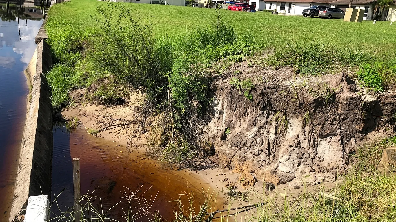
Land subsidence affects an estimated 2 billion people and puts about $8.17 trillion in economic activity at risk worldwide.
With parts of Lagos reported to be subsiding by 2 – 87 millimetres a year, African urban resilience must look below the floodwater, towards groundwater use, land pressure, infrastructure design, data gaps and the unequal burden carried by informal communities.
The Climate Risk Rising From Below
Some of the world’s fastest-growing cities are not only facing rising seas and heavier rainfall; parts of the ground beneath them are moving down.
The World Economic Forum describes urban land subsidence as a slow, under-recognised risk that can turn manageable flooding into infrastructure failure, displacement and lasting economic loss.
The scale is significant. Subsidence is estimated to affect 2 billion people and 6.3 million square kilometres of land.
Potential economic exposure reaches $8.17 trillion, approximately 12% of global gross domestic product.
Without substantial mitigation investments, flood risks associated with sinking could cost coastal cities an estimated $635 billion a year by 2050.
For Africa, the warning is concentrated in cities where rapid construction, groundwater dependence, weak drainage, informal settlement and coastal exposure already interact.
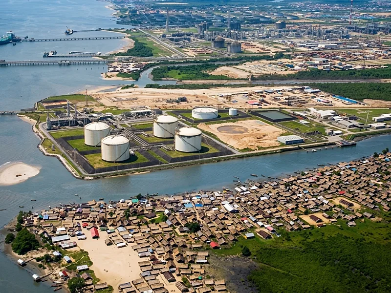
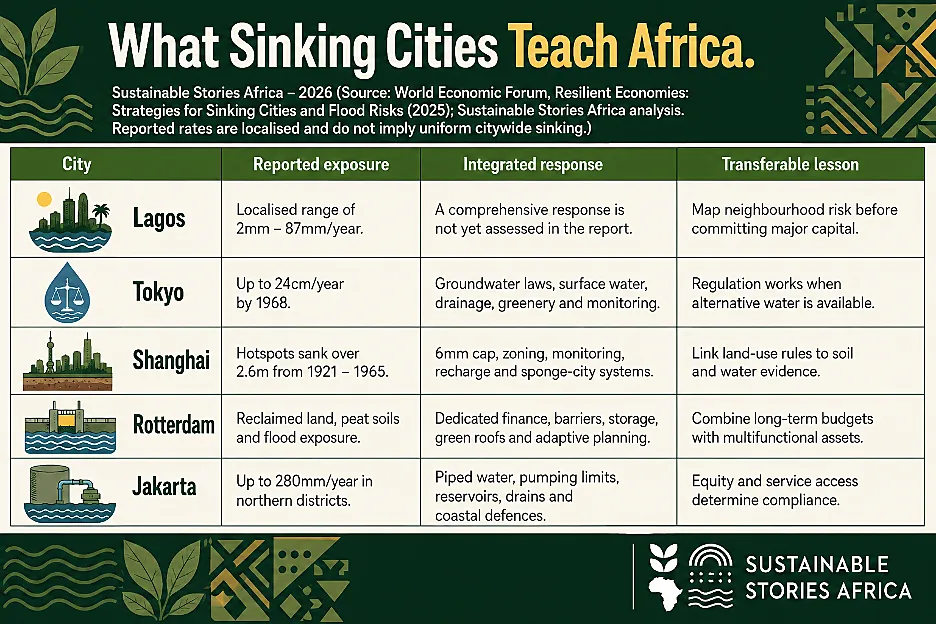
The report’s map shows localised areas in Lagos with an estimated subsidence rate of 2 – 87 millimetres per year.
That does not mean the whole city is sinking uniformly, but it is substantial enough to demand targeted measurement and planning.
Lagos Joins A Global Sinking Map
Subsidence often stays invisible until roads deform, pipes fracture, foundations crack, or drainage fails.
- Its danger lies in compounding other hazards: sinking land lowers flood defences, allows storm surges to travel farther inland, and alters drainage gradients, leaving infrastructure vulnerable to rainfall it wasn't engineered for.
WEF's city examples show how quickly rates escalate.
- Jakarta has recorded up to 280 millimetres of sinking annually
- Mexico City, 350 – 450 millimetres locally
- Tokyo reached 24 centimetres a year by 1968 before regulation shifted its trajectory.
- Lagos' reported 2 – 87 millimetres range is lower; however, dense assets and social vulnerability magnify every centimetre's impact.
Financial consequences ripple through public budgets and private balance sheets, falling property values, rising maintenance costs, widening insurance gaps and disrupted supply chains.
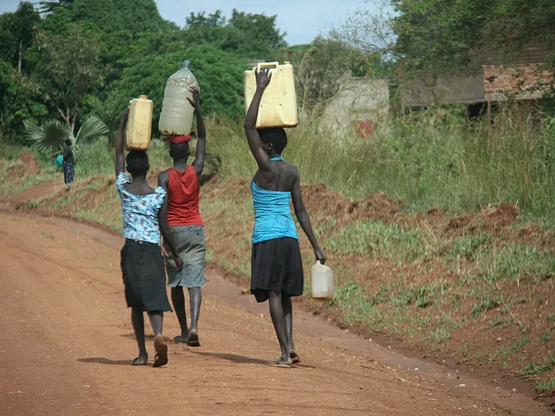
Social costs fall even more unevenly: informal settlements often have weaker drainage, insecure tenure and fewer recovery resources, meaning identical ground movement can produce starkly different outcomes across neighbourhoods.
Groundwater Pressure Makes Risk More Unequal
Human activity is the dominant accelerant.
Research cited in the report;
- Links about 77% of examined subsidence cases to human actions.
- Approximately 60% directly attributed to groundwater withdrawal.
- Another global assessment assigns 55% of identified drivers to groundwater extraction, ahead of urbanisation, tectonic processes, natural compaction, mining and other causes.
Pumping water faster than aquifers can recharge compacts underground layers, and that compression can be difficult or impossible to reverse.
Urbanisation intensifies the pressure.
- Heavy buildings and reclaimed land can load weak or compressible soils, while roads and hard surfaces reduce natural recharge.
- Water demand also rises in households, agriculture, manufacturing and technology facilities.
The report estimates that 12% of soil compaction is attributable to urbanisation, a concern as the global urban population moves from nearly 58% towards a projected 68% by 2050.
Climate change multiplies rather than replaces these risks.
- Heat and drought can increase groundwater extraction when surface supplies fail, while sea-level rise, saltwater intrusion and intense rainfall expose the consequences of lower land.
- A narrow flood-control project may therefore miss the cause.
- Building a higher wall while groundwater pumping continues can protect one edge of a city while the land behind it keeps falling.
Four Cities Show Recovery Is Possible
Tokyo demonstrates that decisive regulation can reverse a trajectory.
- National and metropolitan authorities restricted groundwater use and well construction, shifted demand towards surface water, expanded a network of about 600 water facilities and invested in drainage.
- Its underground discharge channel has prevented more than JPY150 billion in potential flood damage since 2006 and diverted over 12 million cubic metres of water during
- Typhoon Hagibis in 2019. Subsidence in some datasets slowed to about one centimetre a year.
Shanghai combined;
- A six-millimetre annual subsidence cap with monitoring, zoning, artificial groundwater recharge, building requirements and sponge-city infrastructure.
- Its average annual rate has fallen to about five millimetres, although local differences remain.
Rotterdam adds the lesson of sustained financing:
- The Dutch Delta Works programme has an annual €1.25 billion budget through 2032, while the city combines large barriers with water squares, green roofs and satellite-based monitoring.
Jakarta shows both ambition and equity tests.
- It is expanding retention wells, reservoirs and drainage channels, constructing a 37.3-kilometre coastal defence system, restricting groundwater in large buildings and targeting 100% piped-water coverage by 2030.
The report stresses that enforcement will fail if safe, affordable alternatives do not reach households and businesses
Resilience succeeds when regulation and service provision move together.
African Cities Need Systems Before Seawalls
African governments should start with a shared evidence base on subsidence and groundwater.
Satellite interferometry, ground sensors, observation wells and community reporting can reveal where movement occurs and how it interacts with drainage, buildings and water systems.
- Coastal cities like Lagos need regularly updated risk maps that distinguish neighbourhood-level movement from citywide averages, usable for zoning and capital planning.
Water policy must target the root driver: progressively reducing unsustainable abstraction while expanding surface, recycled and piped water alternatives.
Building codes should mandate geotechnical surveys, water-conscious design and stormwater absorption in high-risk zones, with nature-based systems, such as wetlands, mangroves, and permeable surfaces, planned as infrastructure, rather than decoration.
Finance and business practices must adapt too.
- Banks and insurers can factor subsidence into credit and underwriting; utilities should monitor assets for differential settlement.
- Developers should disclose groundwater and foundation risks.
- Blended finance, green bonds and public-private partnerships can fund resilience projects, provided costs and benefits stay transparent.
Communities must act as decision-makers, not just beneficiaries.
Informal residents often hold the deepest knowledge of water levels and drainage patterns; their participation, paired with social protection, ensures resilience investments don't become a pretext for displacement.
The core principle: govern land, water, housing and climate adaptation together.
Path Forward – Resilience Must Begin Beneath The City
Lagos and other African cities should treat land subsidence as a core climate and infrastructure risk, establish credible monitoring, regulate groundwater use and align building, water and drainage investments with local geology.
The priority is prevention backed by equitable services.
When governments, businesses, financiers and communities share data and act before failure, cities can protect assets, reduce flood losses and build resilience from the ground up.