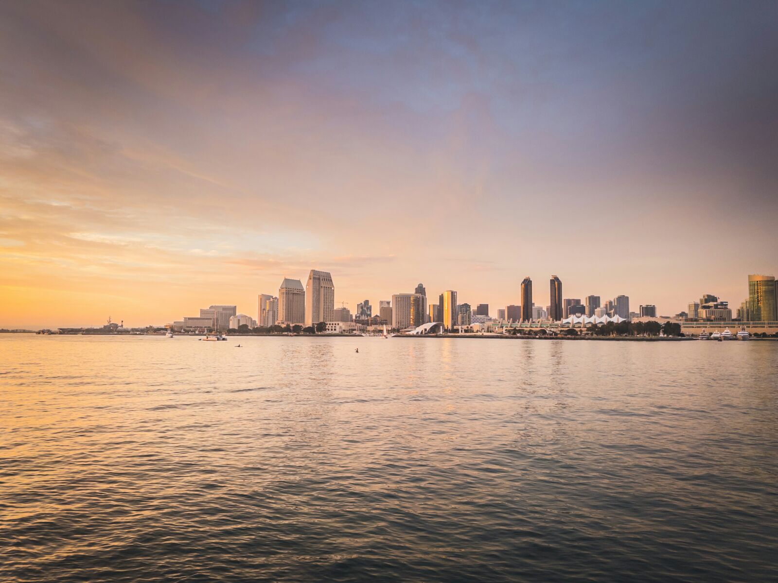
Pacific island cities are growing fast, but climate and disaster risks are growing with them.
A World Bank spotlight argues that resilience now depends on better diagnostics, stronger planning, and investment choices shaped by evidence.
The report’s message reaches beyond the Pacific. For African coastal cities and island states, the same question applies: can urban growth be guided before floods, heat, erosion and weak infrastructure lock in future losses?
Risk Data Must Shape Growth
Pacific Island Countries are entering a decisive urban moment. Their towns and cities are expanding at the same time as sea level rise, flooding, tropical cyclones, earthquakes and heat stress are intensifying across fragile coastal landscapes.
A World Bank and Global Facility for Disaster Reduction and Recovery spotlight, Tides of Change – Urban Resilience Across Pacific Landscapes, frames this as a planning challenge, not only a climate emergency.
It reports that the urban population across 10 Pacific Island Countries grew by 175% between 1994 and 2024, rising from about 600,000 to more than 1 million, and is projected to reach 1.6 million by 2050.
The implication is clear for the Global South: cities cannot afford to grow first and retrofit resilience later
For African coastal economies from Lagos to Abidjan, and island states from Cabo Verde to São Tomé and Príncipe, the Pacific story is a warning about what happens when urbanisation, informality and climate exposure converge faster than institutions can respond.
Urban Growth Meets Climate Exposure
The World Bank spotlight lands on a stark number: average annual disaster losses across the Pacific are estimated at $1.075 billion, equivalent to nearly 5% of the region’s combined GDP.
By 2050, the number of people exposed to earthquake and cyclone hazards in 38 selected Pacific urban centres is expected to more than double, while the value of exposed assets is projected to rise by 74%.
That is the heart of the report’s news value. Urban growth is no longer a slow demographic trend. It is becoming a balance-sheet risk, a public-finance risk and a social-protection risk.
The report argues that resilience must be built around four reinforcing building blocks: stronger risk-informed urban management systems, resilient infrastructure and housing, better preparedness for shocks, and social inclusion that brings vulnerable communities into planning.
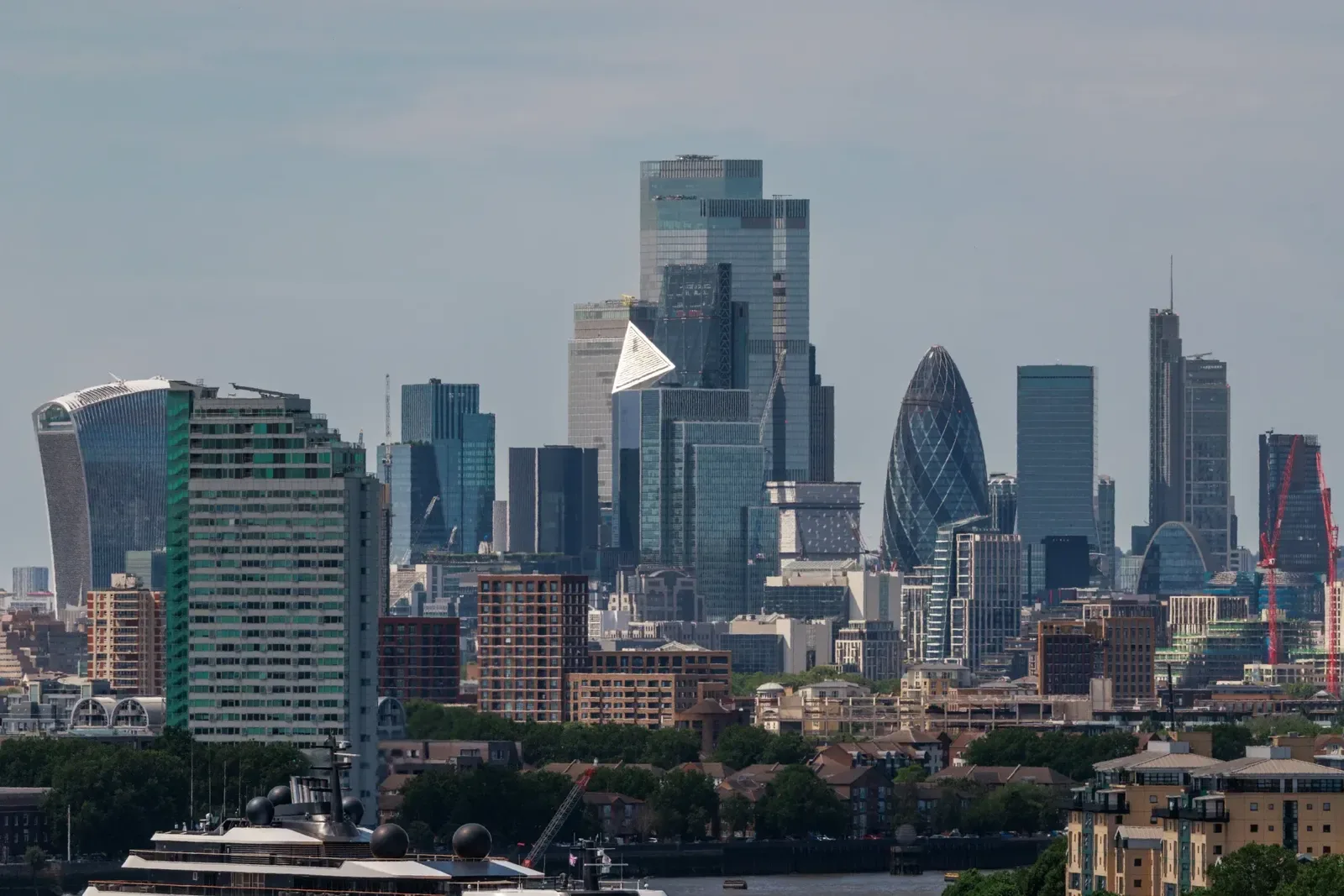
For African markets, the resonance is immediate. Coastal flooding, informal settlements, weak drainage, road-network fragility, land-tenure complexity and limited municipal finance are not Pacific-only problems.
They are also among the defining governance tests of Africa’s fast-growing urban corridors.
Three Tools Turn Risk Into Decisions
The report’s most practical contribution is its comparison of three diagnostic tools for urban resilience:
- Detailed Multi-hazard Risk Assessments
- Critical Hazard Assessments
- Rapid City Scans.
Each tool answers a different planning question depending on data, capacity, urgency and available finance.
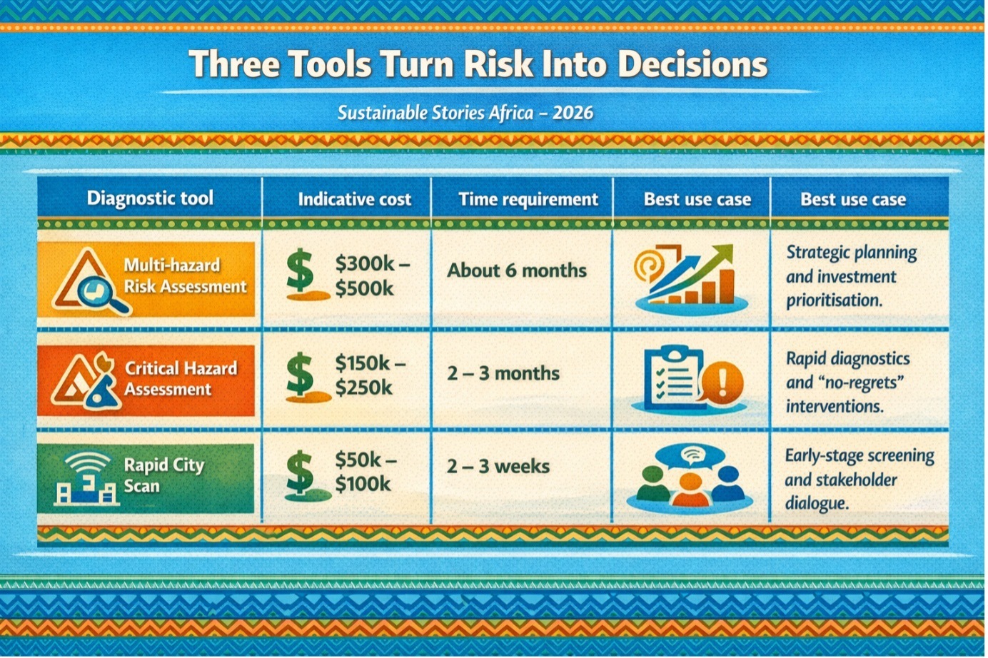
The value of this framework is its realism. Not every city can immediately afford high-resolution modelling. Not every municipality has the technical staff, geospatial data or institutional coordination needed for a full multi-hazard assessment.
However, every city needs some form of risk intelligence before it approves new housing, expands road networks or places critical infrastructure in exposed zones.
The World Bank describes diagnostics as part of an iterative decision-making cycle: they establish evidence, guide investment, support implementation, and create baselines for monitoring progress.
Without that evidence, governments may struggle to justify adequate budget allocations for urban resilience.
This is where the Pacific report becomes a governance lesson. Data is not just technical infrastructure.
- It is a political infrastructure.
- It helps ministries, municipalities, communities and financiers agree on where the greatest risks are
- Where should limited money go first?
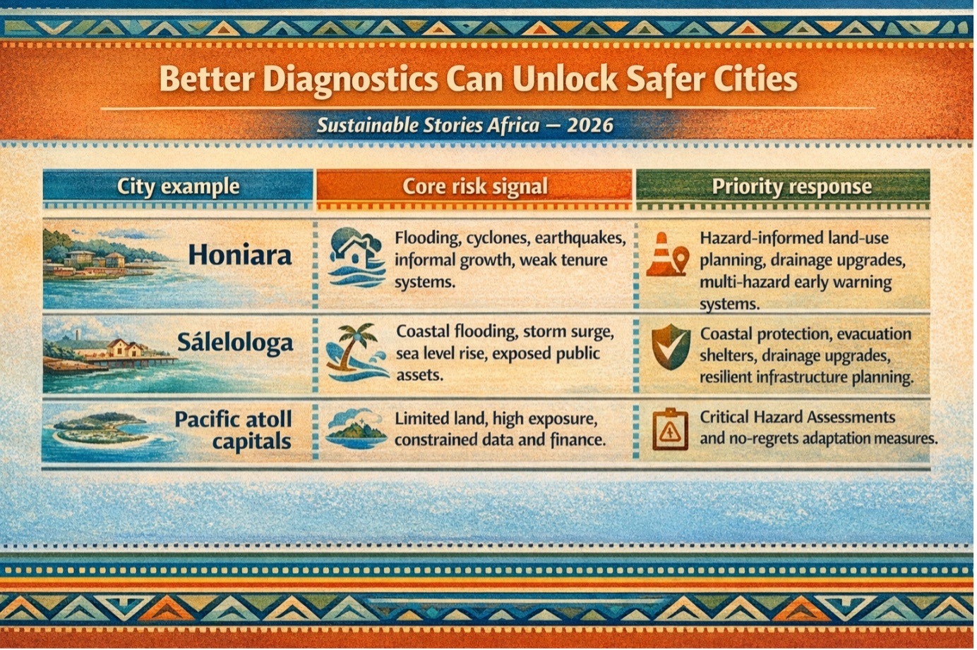
Better Diagnostics Can Unlock Safer Cities
The report’s case studies show what becomes possible when diagnostics move from maps to investment choices.
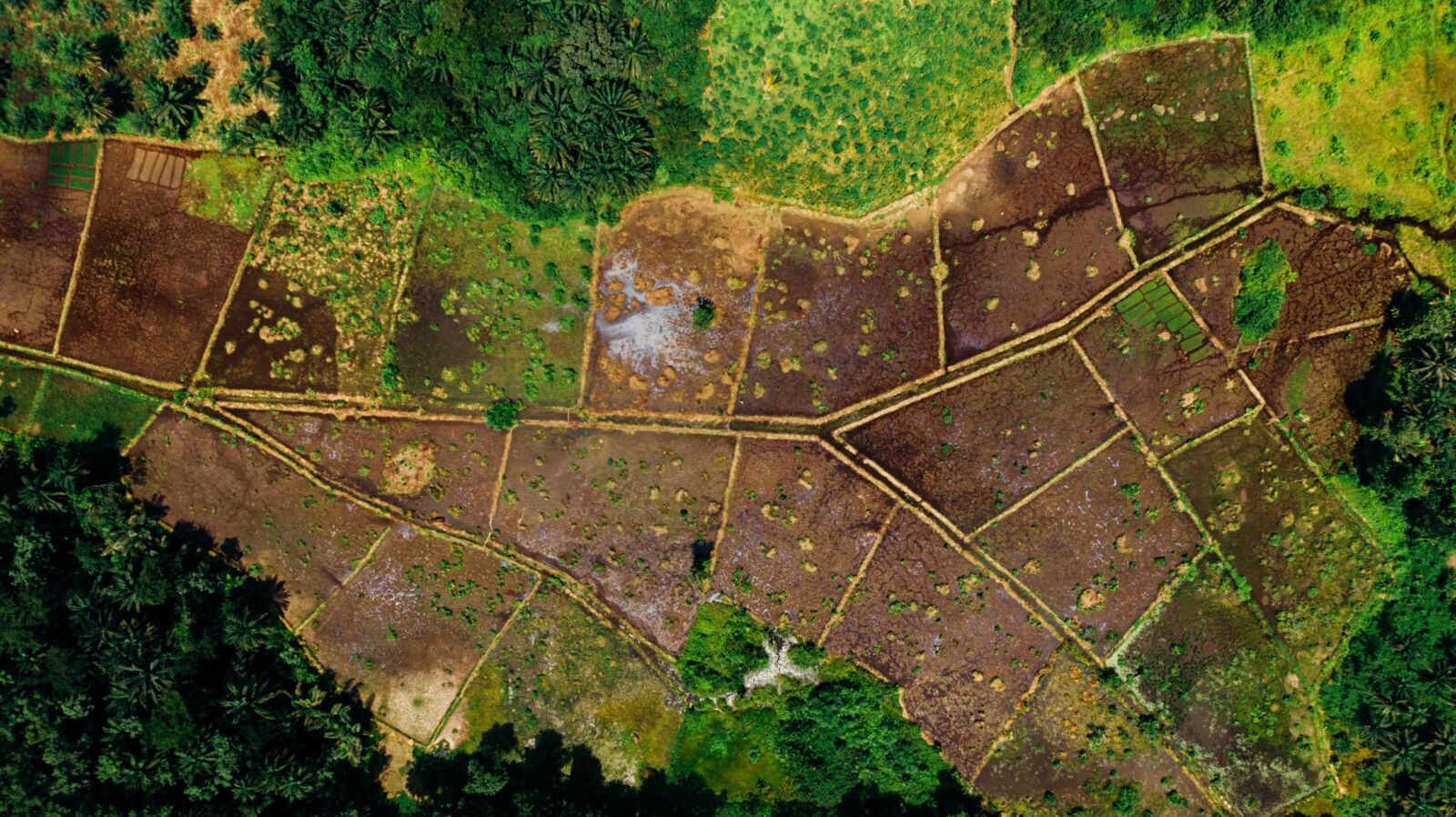
In Honiara, the capital of Solomon Islands, rapid population growth, complex land tenure and high exposure to overlapping hazards have intensified pressure on land, housing, infrastructure and services.
Honiara accommodates more than 80% of the country’s urban population, but expansion into river corridors, coastal zones and peri-urban areas has increased vulnerability.
The assessment identifies “Very High” to “Extremely High” risk zones around the Lungga River Delta and adjacent coastal areas, including critical assets such as Kukum Highway, Honiara International Airport, Port Cruz and logistics facilities.
The report also notes that approximately 63% of building stock is non-engineered construction, leaving it vulnerable to cyclone-intensity winds.
In Sālelologa, Samoa, the resilience challenge is different but equally instructive. The township is strategically important as an administrative and transport hub for Savai’i, hosting the island’s main wharf and ferry terminal, schools and Maota Airport.
However, flooding is its most significant risk, followed by high-velocity winds, tsunamis, extreme heat and earthquakes.
These examples show the upside of risk-informed planning. Better diagnostics can guide safer land use, stronger building codes, climate-resilient roads, protected ports, upgraded drainage, early warning systems and targeted support for vulnerable settlements.
For African readers, the opportunity is clear. The same diagnostic ladder can help cities decide where to restrict development, where to invest in drainage, which roads are critical during emergencies, and which communities need protection before disasters occur.
Move From Reports To Investments
The report stresses that resilience diagnostics must be used, not shelved. Their value lies in shaping zoning reforms, hazard-informed land-use plans, stronger land administration, better municipal finance, retrofitted schools and hospitals, early warning systems, and safeguards for vulnerable groups.
For African governments, this means making diagnostics routine in urban governance, with hazard screening for housing, roads, ports, airports and industrial parks, backed by geospatial risk platforms, climate expenditure tracking and public dashboards.
For financiers, diagnostics create bankable, evidence-based project pipelines, while citizens benefit when inclusion, participatory planning and protection for vulnerable groups are built in.
That matters in African cities, where informal settlements often face the greatest climate risk but remain least represented in formal planning and investment decisions
Path Forward – Resilience Needs Evidence First
Pacific cities show that urban resilience must begin before disaster strikes. The priority is to turn risk diagnostics into land-use decisions, infrastructure pipelines, early warning systems and inclusive community protection.
For African and emerging-market cities, the message is direct: growth without risk data is expensive.
Safer urbanisation will require evidence, finance, coordination and political discipline, before today’s exposed settlements become tomorrow’s permanent losses.