Research traces power across fourteen countries
A Geoforum study examines 24 land governance cases in sub-Saharan Africa.
It finds that governments can use investments, corridors, protected areas and land records to extend or consolidate authority.
The findings raise questions about how these changes affect communities’ rights and access to land.
Land deals can extend state authority
African governments can use foreign investment and land administration reforms to strengthen their control over land.
This is according to a study by Yuezhou Yang and Carolin Dieterle published in Geoforum.
- The researchers examined 24 cases across 14 sub-Saharan African countries.
- They found that infrastructure, conservation and agricultural investments can extend public authorities' reach, while registries, technical surveys and regulations can consolidate it over time.
The study draws on fieldwork conducted between 2018 and 2024 in Uganda, South Africa, Tanzania, Zambia and Kenya, alongside evidence from published research elsewhere in the region.
- It challenges accounts that interpret large land deals chiefly as evidence of governments yielding to investors.
The cases suggest that governments can use external capital and expertise to pursue territorial goals, with outcomes shaped by negotiation and disputes among agencies, communities and other authorities.
Two ways authority changes
The authors use widening to describe the extension of government authority into areas where it was previously limited or indirect.
- An infrastructure corridor can create new rules about access, land allocation and compensation.
- A conservation designation can give agencies greater control over entry or use.
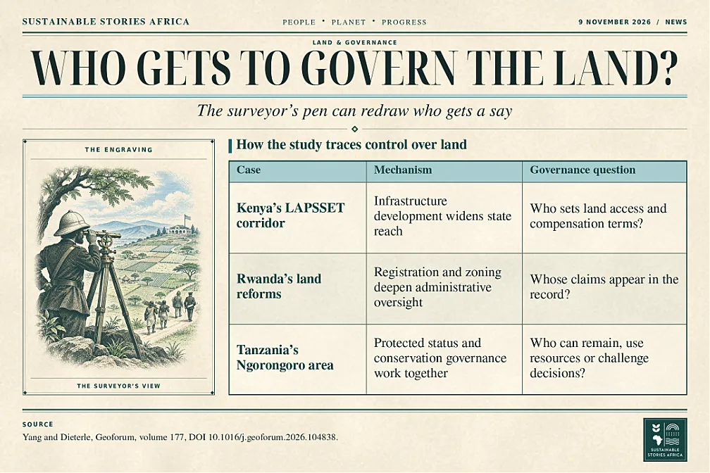
In Kenya, the study examines the Lamu Port–South Sudan–Ethiopia Transport corridor as an example of how infrastructure development can extend state reach.
- Deepening describes how authority becomes more embedded in day-to-day administration.
- Mechanisms include mapping, registration and technical assessments.
In Rwanda, the paper discusses nationwide land registration and zoning as ways to extend administrative oversight.
In Tanzania, the Ngorongoro case illustrates how conservation designation can over time interact with ecological expertise and official accounts of who belongs in a protected landscape.
The authors also examine the Southern Agricultural Growth Corridor of Tanzania, where an initiative framed around investment and agricultural development involved decisions about the status and allocation of village land.
- This example shows how a project’s financial purpose can be intertwined with changes in legal authority.
- For a village, the main question may be which institution can approve land use that residents previously managed or accessed under other arrangements.
Stronger administration has uneven effects
Land records can help people establish boundaries and support disputes.
- Their usefulness depends on what the records recognise and how they can be corrected.
A map showing a parcel owner may leave seasonal grazing, shared access to water or informal tenancy.
- For affected households, changes in how the state records land can change which claims officials consider when a project is approved.
The study also identifies tensions in conservation governance.
- The same institutions that protect habitat can impose new limits on people whose livelihoods depend on the area.
When authority shifts from local institutions to national agencies, consultation and appeal procedures become especially important.
- The researchers’ framework helps explain how authority changes.
The legitimacy of a specific decision still depends on the circumstances and rights treatment.
Put land rights into project scrutiny
Lenders and public agencies can use the study’s questions when reviewing projects that require land.
- Early assessments can identify formal and customary claims, seasonal land use and disputes over who represents affected people.
- Publishing a map and providing people with a way to correct it before commitments are made would make exclusions easier to identify.
Where a project brings new restrictions, documentation can show who set the rules, which groups were consulted and what remedies are available.
Monitoring after approval matters as well.
- A corridor or protected area can change in scope, and technical registry updates can shift communities’ practical position years after the original decision.
- The cases give reviewers a reason, after a project is launched, to know how power operates.
The cases also differ in how decisions can be challenged.
- A dispute over a boundary in a registry might require an administrative correction.
- A dispute over access to a conservation area could involve the rules governing the entire landscape.
For investors and public agencies, those different routes affect which institution should hear a complaint and when communities can raise it.
Path Forward – Track land rights as projects advance
Public authorities and funders can document who gains decision-making power as land is allocated, mapped or protected.
Records should show how customary and seasonal claims were considered and how disputes can be heard.
The test is whether communities can use those processes when investment and conservation decisions change their access to land.