United Nations member states have endorsed wider use of maps that show continents in more accurate relative sizes.
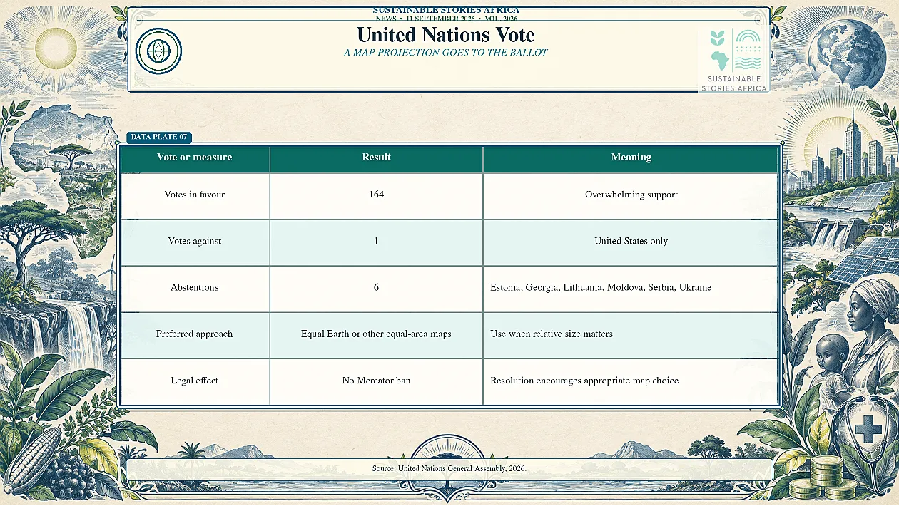
The African-led resolution passed by 164 votes to one, with six abstentions, but does not ban the Mercator projection.
It encourages governments, schools, international organisations and technology companies to use Equal Earth or other equal-area maps when size matters.
Africa Wins a Cartographic Correction
United Nations member states have backed a resolution promoting world maps that represent the relative size of continents more accurately, delivering a major diplomatic victory for an African-led campaign against the continued dominance of the Mercator projection.
The September 4 vote passed 164 to one, with six abstentions.
- The United States cast the only vote against, while Estonia, Georgia, Lithuania, Moldova, Serbia and Ukraine abstained.
- Togo led negotiations for the African group, building on an African Union-backed effort that argues distorted maps have contributed to the symbolic minimisation of Africa.
Navigation Design Became Global Default
Gerardus Mercator developed his projection in 1569 for maritime navigation.
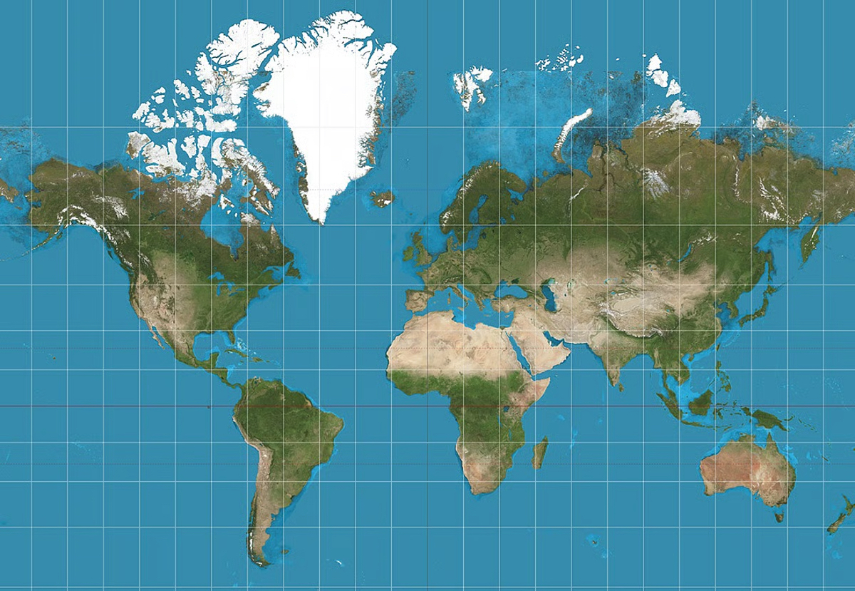
- It preserves compass bearings, allowing sailors to plot straight courses, but greatly enlarges landmasses as they move away from the Equator.
- Greenland can therefore appear similar in size to Africa even though Africa is about 14 times larger.
A tool designed for a specific navigational purpose became common in classrooms, newsrooms, official publications and digital platforms.
- The problem is not that Mercator is mathematically wrong; every flat map distorts a spherical planet.
- The problem is using one distortion without explaining what it changes.
Resolution Promotes Equal Area Options
The resolution does not ban Mercator or impose one replacement.
- It encourages governments, schools, international organisations and technology companies to use Equal Earth and other equal-area projections when relative size matters, and to teach the limitations of all flat maps.
- Equal Earth, developed in 2018, seeks a visually balanced world map while preserving proportional area.
Togo's foreign minister, Robert Dussey, told delegates that maps guide education, imagination and collective perceptions.
He also acknowledged Mercator's continued usefulness for navigation.
- France announced before the vote that it planned to abandon Mercator for its world maps, aligning itself with the African campaign.
Representation Shapes Education and Power
Changing a classroom map will not alter Africa's land area, borders or economic weight.
- It can, however, correct a visual hierarchy that generations have absorbed.
- Accurate scale supports geography education, climate communication and public understanding of distances, resources and populations.
- It also demonstrates how technical standards can carry historical choices long after their original purpose has faded.
Education ministries, publishers and technology platforms should audit where Mercator remains the default and select projections according to purpose.
- Navigation applications may still need angle-preserving maps, while atlases, dashboards and policy presentations comparing area should use equal-area alternatives.
- Clear labelling is as important as replacement.
The transition should be practical, not ceremonial.
- School systems need updated atlases, teacher guidance and digital resources; newsrooms need map templates that preserve accurate areas; and software companies need default settings suited to different tasks.
- Procurement standards can accelerate these changes at low cost.
- Researchers should also monitor whether new materials improve geographic understanding, including how students compare Africa with Europe, North America and Greenland.
Path Forward – Makes Map Choices Transparent
Institutions should use equal-area maps for size comparisons and explain the navigation requirement choice for any other projection.
African educators and cartographers should help shape updated materials so technical accuracy also supports fairer global understanding.