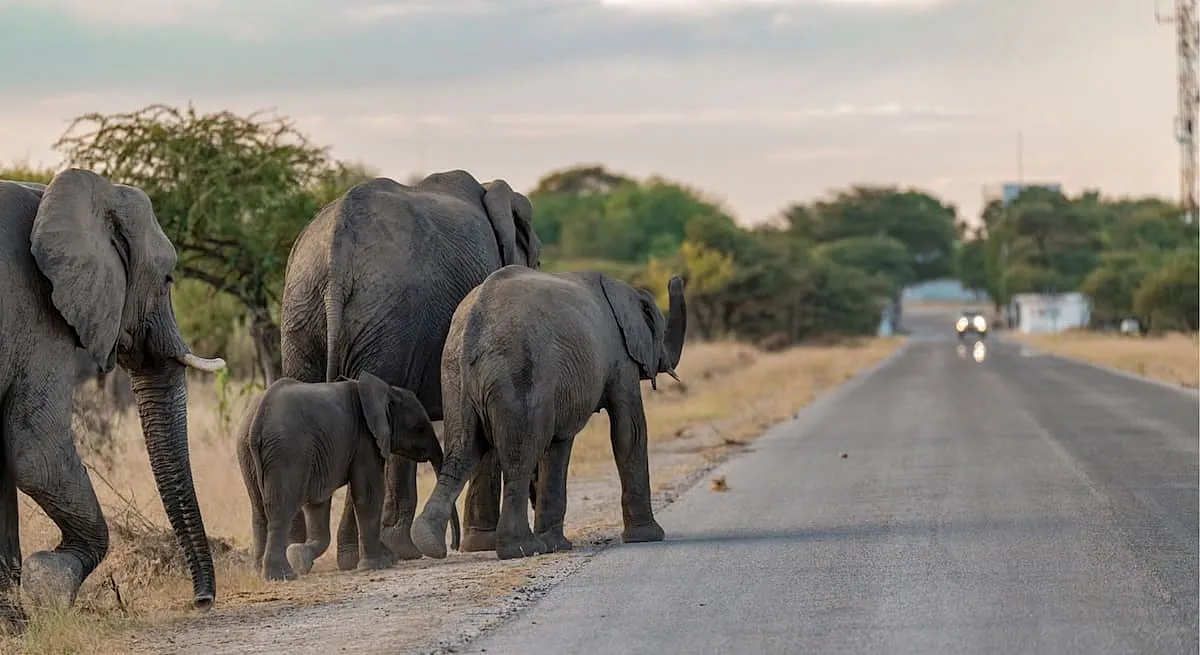
Human-elephant conflict across a Southern African transboundary landscape is projected to expand sharply through 2085 as population growth, cropland and built areas press further into elephant ranges.
A new study finds human land-use expansion is the dominant driver, ahead of climate pressure, giving governments and communities a critical window to plan coexistence before today's hotspots intensify.
Southern Africa's Coexistence Window Is Narrowing
Southern Africa's elephant conservation success is colliding with a fast-expanding human footprint.
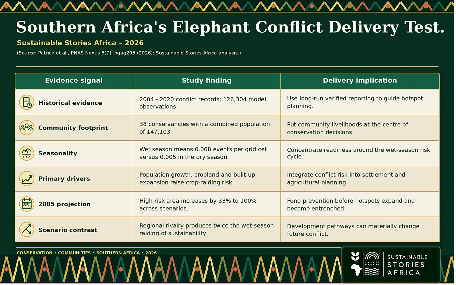
A 2026 PNAS Nexus study projects that the area at high risk of human-elephant conflict could increase by 33% to 100% by 2085 across a landscape spanning northern Namibia, much of northern Botswana and parts of Angola and Zambia.
Conflict events are also expected to become more frequent under every climate-development pathway examined.
The research matters because it moves beyond describing where crop raiding happens today. Using conflict records from 2004 to 2020, the authors combined panel-data regressions with machine-learning point-process models to identify drivers and map future hotspots.
The two approaches differ; however, they converge on the same central finding
- Human population growth and land conversion are stronger drivers of future conflict than climate change alone.
That finding is both a warning and an opportunity.
- It means intensifying conflict is not simply an unavoidable consequence of a warmer climate
- Decisions about settlement, cropland, roads, fences, wildlife corridors and local mitigation can still influence whether communities and elephants are pushed into deeper competition.
Conflict Risk Could Double by 2085
The study covers Africa's largest transboundary conservation landscape and a region central to savanna elephant recovery.
- Southern Africa supports more than 290,000 savanna elephants, roughly 70% of the continental population, according to the researchers.
- Within the Namibian portion of the analysis, 38 communal conservancies were home to 147,103 people and provided the verified conflict records used to train the models.
More than 90% of reported human-elephant conflict events in the dataset involved crop raiding.
- The pattern was sharply seasonal. At the two-kilometre grid-cell level, wet-season counts ranged from zero to 75 events, with a mean of 0.068.
- Dry-season counts ranged from zero to 28, with a mean of 0.005.
- Average wet-season crop raiding was therefore more than ten times higher.
Looking forward, every scenario produced moderate-to-large increases in crop-raiding events and a wider conflict footprint.
The high-risk area is projected to grow by one-third to as much as 100% by 2085. The result does not mean every location will double.
Still, it signals a major expansion in the geography where communities may face losses, safety risks and rising pressure on their support for conservation.
Human Expansion Outweighs Climate Pressure Today
The causal analysis found that rising human population was a significant predictor of crop raiding in both wet and dry seasons.
- During the wet season, increases in cropland and built-up cover were also associated with higher conflict.
- Drier conditions inside core elephant-protected areas mattered too, apparently pushing elephants towards resources in nearby community and farming areas.
However, population and land-use change were more predictive overall.
Landscape design added another layer.
- Areas closer to wildlife fences and farther from roads were more likely to experience conflict in the researchers' random-effects analysis, suggesting that infrastructure can constrain or channel elephant movement.
- The machine-learning models also identified tree cover, distance to roads, distance to fences, population and distance to rivers as important parts of the risk pattern.
The projected scenarios reinforce the point.
- SSP3-RCP7.0, described as regional rivalry, produced the worst conflict outlook, with twice as much wet-season crop raiding as the SSP1-RCP2.6 sustainability pathway.
- The fossil-fuelled development scenario delivered stronger climate impacts but relatively less land conversion and more moderate population growth in Namibia, so its projected conflict rate was lower than under regional rivalry.
Human development choices, not emissions severity alone, shaped the largest increase.
Foresight Can Protect People and Elephants
Seeing potential hotspots decades ahead changes the policy conversation.
- Conflict management is often reactive: a field is raided, a household reports a loss, officials verify the incident, and compensation or deterrence follows.
- Forecasting creates space to act before the damage becomes routine.
The study identifies persistent risk around northern Etosha National Park, Namibia's Zambezi Region, areas north of Khaudum National Park, the Okavango Delta and the edge of Moremi Wildlife Reserve.
- These are not merely conservation zones.
- They are lived landscapes where farming, mobility, tourism and wildlife governance intersect.
Proactive planning can protect household incomes and food security while preserving connectivity between elephant ranges.
It can also reduce the political tension that arises when communities bear the cost of conservation but receive uncertain benefits.
The researchers point to elephant-sensitive land-use planning, local scout-based monitoring and deterrents as useful areas for further local-scale work.
The opportunity is to combine regional foresight with responses designed around how people farm, move and report conflict in each hotspot.
Planning Must Move Ahead of Conflict
Governments should first;
- Include human-elephant conflict risk inside land-use, agricultural and infrastructure planning.
- New farms, settlements, roads and fences should be assessed not only for economic value, but for how they change access to water, movement corridors and the edges between communities and elephant habitat.
- Transboundary coordination is essential because elephants and risk pathways do not stop at national borders.
Second,
- Conservation agencies and local authorities need stronger community reporting and early-warning systems.
- The historical dataset may undercount real incidents, so more accessible reporting, consistent verification and locally trusted monitoring would improve both response and future models.
- Risk maps should guide where scouts, deterrents, compensation readiness and extension support are placed, while avoiding the assumption that one intervention will work everywhere.
Third, finance must reach coexistence measures before conflict peaks.
- Conservation and tourism revenues, public budgets, development finance and climate-adaptation resources can support corridor protection, crop-risk reduction and rapid household assistance.
- The social objective is as important as the ecological one: families should not be left to absorb recurring losses for a conservation outcome that benefits a wider region.
Using the projections must be done carefully.
- They assume a static elephant distribution, hold future roads and fences constant, rely on reported incidents and use generalised land-cover and downscaled climate data.
- They identify plausible directions and priority areas, not precise local destinies. Local ecological knowledge and updated data remain essential for decisions.
Part Forward – Coexistence Depends on Decisions Made Now
Southern Africa still has time to reduce the projected rise in conflict, but the window narrows as cropland, settlements and infrastructure become fixed.
Planning should protect movement routes, strengthen community monitoring and direct finance to prevention and rapid support.
The study's clearest message is that human choices shape risk.
Acting on that evidence can protect rural livelihoods, sustain conservation gains and make coexistence a development objective rather than an emergency response.